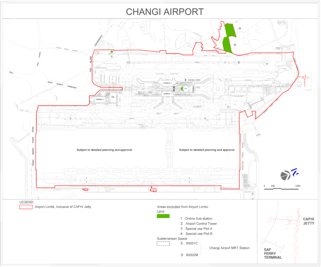
| All that land and water containing an area of about 23,759,361.988 square metres within the limits that are the boundaries of Lot numbers 1246V, 1264P, 1273L, 1275M, 1277V, 1284K, 1288C, 1289M, 1429N, 1882X, 1886W, 1891P, 2050N, 2771W, 2772V, 2773P, 3370C, 3523A, 3524K, 3536T, 3565V, 3566P, 3567T, 3568A, 3787W, 4110A, 4111K, 4112N, 4174N, 4200K, 4269V, 4274T, 4285W, 4288T, 4292A, 4327V, 4348K, 4350A, 4359P, 4360W, 4410N, 4415W, 4417P, 4459M-PT, 4477W, 4478V, 4545X, 4546L, 4547C, 4548M, 4549W, 4550C, 4551M, 4560K, 4561N, 4565M, 4567V, 4568P, 4594L, 4611V, 4612P, 4613T-PT, 4702T, 4707L, 4708C, 4793V, 4794P, 4795T-PT, 4836T, 4837A, 4906V-PT, 4914N, 4915X-PT, 4917C, 4918M, 4941P, 4942T, 4943A, 4966M, 4967W, 4968V, 4969P, 5070T-PT, 5094M, 5121M, 5122W, 5123V, 5124P, 5125T, 5126A, 5222L, 5292P-PT, 80000L and 80006T of Mukim 31, and which is more particularly delineated in the Plan below. |